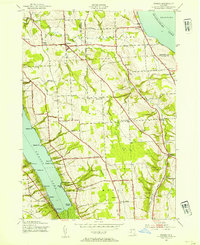
1943 Map of Owasco
USGS Topo · Published 1954About this map
Owasco Lake and Skaneateles Lake define the eastern and western boundaries of this Finger Lakes landscape during the early 1940s. The interior terrain is shaped by the deep incision of Dutch Hollow Brook, with a network of numbered schoolhouses and small crossroads settlements serving the rural population. Notable hubs like Owasco and Niles appear alongside distinct neighborhood markers such as Valentine Corners and Twelve Corners. Local history and genealogy are well-represented by several burial sites, including the Owasco Cem and Conklin Cem. The map captures an era of localized industry and education, evidenced by the Twelve Corners (Quar) and school buildings like School No 10. Shoreline landmarks such as Indian Cove and Southeast Owasco indicate the early development of these waterfronts before later twentieth-century expansion.
Find a feature on this map
65 named features on this map. Tap any name to fly to it.
Don’t see what you’re looking for? This feature index may not catch every label — zoom into the map to look around manually.
Map Details
Editions of this 1943 Owasco Map
2 editions found

Other maps of this area

1898 · Moravia
USGS Topo · 1:62,500

1899 · Auburn
USGS Topo · 1:62,500

1899 · Skaneateles
USGS Topo · 1:62,500

1902 · Skaneateles
USGS Topo · 1:62,500

1902 · Moravia
USGS Topo · 1:62,500

1902 · Genoa
USGS Topo · 1:62,500

1902 · Auburn
USGS Topo · 1:62,500

1942 · Genoa
USGS Topo · 1:24,000

1943 · Moravia
USGS Topo · 1:31,680
1943 · Genoa
USGS Topo · 1:31,680