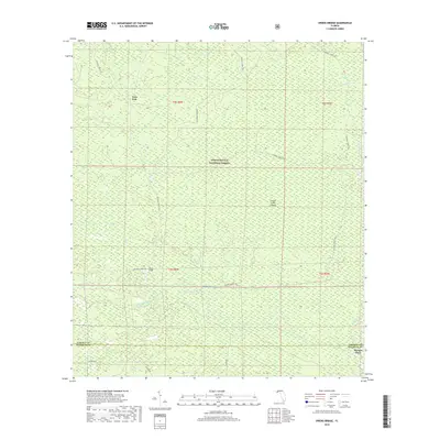
2018 Map of Owens Bridge
USGS Topo · Published 2018About this map
Apalachicola National Forest dominates this section of the Florida Panhandle, where the landscape is defined by the intricate hydrology of the New River and its numerous tributaries. The territory transitions between dense forest and specialized wetland environments like Mud Swamp and Gum Bay. Local points of interest such as Twin Pole and the crossing at Owens Bridge suggest a sparse human footprint centered on timber and forest management. The southern boundary of the map tracks the line between Liberty and Franklin counties, where Tucker Rd and Sumatra Rd provide access to the interior. The presence of Juniper Creek Islands and Big Slough Branch highlights the complex network of slow-moving water and seasonal drainages that characterize this low-lying region.
Find a feature on this map
22 named features on this map. Tap any name to fly to it.
Don’t see what you’re looking for? This feature index may not catch every label — zoom into the map to look around manually.
Map Details
Editions of this 2018 Owens Bridge Map
This is the sole edition of this map. No revisions or reprints were ever made.
Other maps of this area

1944 · Pickett Bay
USGS Topo · 1:31,680

1944 · Queens Bay
USGS Topo · 1:24,000

1945 · Thousand Yard Bay
USGS Topo · 1:31,680

1945 · Smith Creek
USGS Topo · 1:31,680

1945 · Tates Hell Swamp
USGS Topo · 1:31,680

1945 · Pickett Bay
USGS Topo · 1:31,680

1945 · Fort Gadsden
USGS Topo · 1:31,680

1946 · Queens Bay
USGS Topo · 1:31,680

1946 · Sumatra
USGS Topo · 1:31,680

1946 · Owens Bridge
USGS Topo · 1:31,680