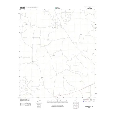
2010 Map of Owens Creek NE
USGS Topo · Published 2010About this map
Bill West Draw meanders through this arid reach of West Texas, defining a landscape where water and energy dictate the patterns of human activity. The map reveals the infrastructure of the Permian Basin's petroleum industry, anchored by the World West Oil Field in the northwest. Beyond the oil operations, the territory is primarily organized around livestock management, evidenced by a network of isolated water sources named for specific land divisions or local figures. These vital points, including the Double Windmill, Six Section Windmill, and Alto Windmill, illustrate the sparse but essential points of contact in an area defined by large-scale ranching and industrial extraction.
Find a feature on this map
8 named features on this map. Tap any name to fly to it.
Don’t see what you’re looking for? This feature index may not catch every label — zoom into the map to look around manually.
Map Details
Editions of this 2010 Owens Creek NE Map
This is the sole edition of this map. No revisions or reprints were ever made.
Other maps of this area
1920 · Big Lake
USGS Topo · 1:62,500
1922 · Big Lake
USGS Topo · 1:62,500
1928 · Rankin
USGS Topo · 1:125,000

1929 · Sheffield
USGS Topo · 1:125,000

1954 · Sonora
USGS Topo · 1:250,000

1954 · San Angelo
USGS Topo · 1:250,000

1958 · Sonora
USGS Topo · 1:250,000
1958 · San Angelo
USGS Topo · 1:250,000
1965 · San Angelo
USGS Topo · 1:250,000
1967 · Owens Creek SE
USGS Topo · 1:24,000