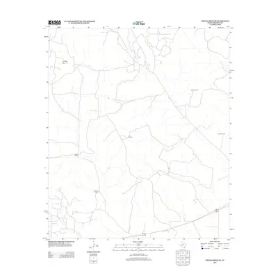
2012 Map of Owens Creek NE
USGS Topo · Published 2012About this map
World West Oil Field defines the industrial footprint of this West Texas landscape, where the petroleum economy and ranching infrastructure coexist across the arid terrain of Crockett County. This 2012 survey illustrates a sparse network of roads and essential water sources, evidenced by several named landmarks like Ranchito Windmill, Alto Windmill, and Bill West Windmill. These features indicate the vital role of groundwater extraction for livestock in a region otherwise dominated by wide-open spaces and oil extraction. Toward the south, Double Windmill and Six Section Windmill further emphasize the distribution of private ranch boundaries and the necessary systems that support life and commerce in this remote corner of the Permian Basin region.
Find a feature on this map
6 named features on this map. Tap any name to fly to it.
Don’t see what you’re looking for? This feature index may not catch every label — zoom into the map to look around manually.
Map Details
Editions of this 2012 Owens Creek NE Map
This is the sole edition of this map. No revisions or reprints were ever made.
Other maps of this area
1920 · Big Lake
USGS Topo · 1:62,500
1922 · Big Lake
USGS Topo · 1:62,500
1928 · Rankin
USGS Topo · 1:125,000

1929 · Sheffield
USGS Topo · 1:125,000

1954 · Sonora
USGS Topo · 1:250,000

1954 · San Angelo
USGS Topo · 1:250,000

1958 · Sonora
USGS Topo · 1:250,000
1958 · San Angelo
USGS Topo · 1:250,000
1965 · San Angelo
USGS Topo · 1:250,000
1967 · Owens Creek SE
USGS Topo · 1:24,000