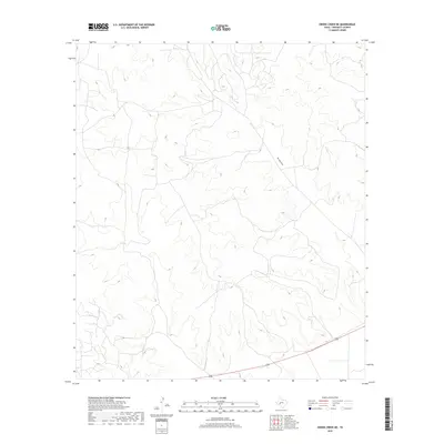
2019 Map of Owens Creek NE
USGS Topo · Published 2019About this map
Bill West Draw snakes through the arid landscape of Crockett County in this contemporary 2019 survey of the Owens Creek NE quadrangle. The terrain is characterized by a dense network of dry washes and high-elevation ridges, typical of the Edwards Plateau region. Most of the map reflects a sparsely populated area where the natural drainage patterns of Bill West Draw are the primary named landmarks. U.S. Route 190 cuts across the southern portion of the sheet, providing the main transit corridor through this expansive territory. This map is an essential record for land managers and researchers studying the modern hydrological and transportation infrastructure in a remote section of the Texas backcountry.
Find a feature on this map
1 named feature on this map. Tap any name to fly to it.
Don’t see what you’re looking for? This feature index may not catch every label — zoom into the map to look around manually.
Map Details
Editions of this 2019 Owens Creek NE Map
This is the sole edition of this map. No revisions or reprints were ever made.
Other maps of this area
1920 · Big Lake
USGS Topo · 1:62,500
1922 · Big Lake
USGS Topo · 1:62,500
1928 · Rankin
USGS Topo · 1:125,000

1929 · Sheffield
USGS Topo · 1:125,000

1954 · Sonora
USGS Topo · 1:250,000

1954 · San Angelo
USGS Topo · 1:250,000

1958 · Sonora
USGS Topo · 1:250,000
1958 · San Angelo
USGS Topo · 1:250,000
1965 · San Angelo
USGS Topo · 1:250,000
1967 · Owens Creek SE
USGS Topo · 1:24,000