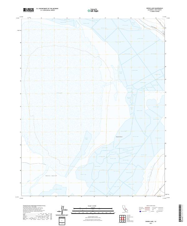
2021 Map of Owens Lake
USGS Topo · Published 2021About this map
Owens Lake dominates this 2021 survey, illustrating the complex hydrology of a landscape where the Owens Valley meets the northern reaches of the Mojave Desert. The map details the modern footprint of the lakebed, showing the arrival of the Owens River from the north and the drainage of Ash Cr at the western edge. Unlike historic surveys that might show a full basin, this contemporary record captures the modern environmental management of the region, including local infrastructure like Keeler Dump Rd near the northeastern shoreline. The survey provides a clear view of the Public Land Survey System grid, including townships like t16s r37e, which overlay the vast, often dry expanse of the lake interior.
Find a feature on this map
10 named features on this map. Tap any name to fly to it.
Don’t see what you’re looking for? This feature index may not catch every label — zoom into the map to look around manually.
Map Details
Editions of this 2021 Owens Lake Map
This is the sole edition of this map. No revisions or reprints were ever made.
Other maps of this area

1905 · Olancha
USGS Topo · 1:125,000

1907 · Olancha
USGS Topo · 1:125,000

1907 · Mt. Whitney
USGS Topo · 1:125,000

1908 · Ballarat
USGS Topo · 1:250,000

1913 · Ballarat
USGS Topo · 1:250,000

1919 · Mt. Whitney
USGS Topo · 1:125,000

1937 · Mt. Whitney
USGS Topo · 1:125,000

1948 · Death Valley
USGS Topo · 1:250,000

1948 · Fresno
USGS Topo · 1:250,000

1950 · New York Butte
USGS Topo · 1:62,500