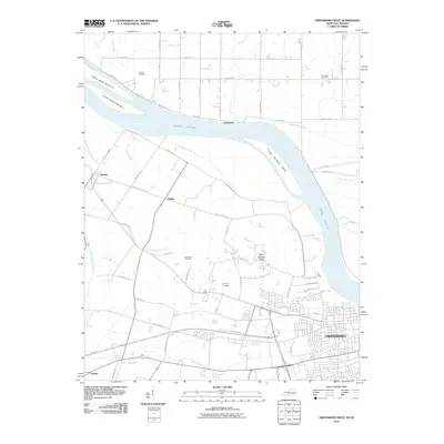
2010 Map of Owensboro West
USGS Topo · Published 2010About this map
The Ohio River flows prominently along the northern edge of this 2010 landscape, shaping the industrial and residential development west of Owensboro. The river environment is defined by its complex hydrology, featuring distinct landforms like French Island Number 1 and Little Hurricane Island, alongside a network of drainage systems including Katie Meadow Slough and the Forked Pond Ditch. Small communities and named crossroads such as Stanley, Griffith, and Enterprise are linked by a grid of rural roads like Griffith Station Rd and Lower River Rd.
Find a feature on this map
49 named features on this map. Tap any name to fly to it.
Don’t see what you’re looking for? This feature index may not catch every label — zoom into the map to look around manually.
Map Details
Editions of this 2010 Owensboro West Map
This is the sole edition of this map. No revisions or reprints were ever made.
Other maps of this area

1901 · Owensboro
USGS Topo · 1:62,500

1905 · Newburg
USGS Topo · 1:62,500

1906 · Sutherland
USGS Topo · 1:62,500

1908 · Calhoun
USGS Topo · 1:62,500

1951 · Yankeetown
USGS Topo · 1:24,000

1952 · Owensboro East
USGS Topo · 1:24,000

1952 · Rockport
USGS Topo · 1:24,000

1952 · Owensboro West
USGS Topo · 1:24,000

1952 · Reed
USGS Topo · 1:24,000

1953 · Sutherland
USGS Topo · 1:24,000