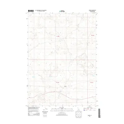
2013 Map of Owinza
USGS Topo · Published 2013About this map
Owinza sits as a primary point of reference in this high-desert portion of Lincoln County, defined by its sparse water sources and essential transport routes. The landscape is marked by isolated water features critical to local livestock or irrigation, including Rock Lake and the Monument Reservoir to the west, while Banner Reservoir lies toward the eastern boundary. This 2013 survey illustrates the reliance on modern thoroughfares like Id-24, which cuts horizontally across the lower sections of the quadrangle. Smaller arteries such as Owinza Rd and S 1850 E provide access to the interior, reflecting the late 20th-century road network that supports this rural agricultural and rangeland district. The presence of Shirley Spring suggests a localized reliance on natural groundwater in an otherwise arid terrain.
Find a feature on this map
13 named features on this map. Tap any name to fly to it.
Don’t see what you’re looking for? This feature index may not catch every label — zoom into the map to look around manually.
Map Details
Editions of this 2013 Owinza Map
This is the sole edition of this map. No revisions or reprints were ever made.
Other maps of this area
1954 · Pocatello
USGS Topo · 1:250,000
1955 · Idaho Falls
USGS Topo · 1:250,000
1955 · Twin Falls
USGS Topo · 1:250,000
1955 · Hailey
USGS Topo · 1:250,000
1958 · Twin Falls
USGS Topo · 1:250,000
1958 · Idaho Falls
USGS Topo · 1:250,000
1958 · Pocatello
USGS Topo · 1:250,000
1959 · Hailey
USGS Topo · 1:250,000
1962 · Hailey
USGS Topo · 1:250,000
1971 · Star Lake
USGS Topo · 1:24,000