
1971 Map of Star Lake
USGS Topo · Published 1973About this map
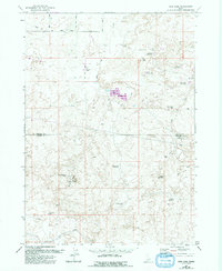
Wilson Butte and the nearby Wilson Butte Cave anchor this high-desert landscape along the border of Lincoln and Jerome Counties. The terrain is defined by a complex network of volcanic depressions and man-made water management systems, including the Gooding Canal and several laterals that indicate the region's reliance on irrigation for ranching. Star Lake Ranch stands as a primary point of settlement in an area otherwise characterized by numerous small reservoirs and seasonal lakes. These water bodies, including Pintail Reservoir, Teal Reservoir, and Rabbit Lake Reservoir, illustrate the strategic collection of water across the arid plains. A system of Jeep Trails provides the primary means of navigation through the sagebrush, connecting remote landmarks like Star Lake Well No 1 and 26 Mile Lake.
Find a feature on this map
24 named features on this map. Tap any name to fly to it.
Don’t see what you’re looking for? This feature index may not catch every label — zoom into the map to look around manually.
Map Details
Editions of this 1971 Star Lake Map
2 editions found
Other maps of this area

1955 · Twin Falls
USGS Topo · 1:250,000

1958 · Twin Falls
USGS Topo · 1:250,000

1964 · Hazelton NE
USGS Topo · 1:24,000

1964 · Perrine
USGS Topo · 1:24,000

1964 · Hunt
USGS Topo · 1:24,000

1971 · Shoshone SE
USGS Topo · 1:24,000

1971 · Owinza
USGS Topo · 1:24,000

1971 · Dietrich
USGS Topo · 1:24,000

1971 · Dietrich Butte
USGS Topo · 1:24,000
1971 · Owinza Butte
USGS Topo · 1:24,000