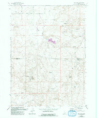
1971 Map of Star Lake
USGS Topo · Published 1992About this map
Star Lake Ranch serves as a lone outpost of human settlement in this high desert landscape, characterized by a complex network of small reservoirs and irrigation works. This 1971 survey, updated in the early 1990s, documents the transition between Lincoln and Jerome counties, where water management is the primary driver of geography. The southern reaches are defined by the Gooding Canal and Milner works, feeding into a series of named water bodies like Rabbit Lake Reservoir and 26 Mile Lake.
Find a feature on this map
24 named features on this map. Tap any name to fly to it.
Don’t see what you’re looking for? This feature index may not catch every label — zoom into the map to look around manually.
Map Details
Editions of this 1971 Star Lake Map
2 editions found
Other maps of this area

1955 · Twin Falls
USGS Topo · 1:250,000

1958 · Twin Falls
USGS Topo · 1:250,000

1964 · Hazelton NE
USGS Topo · 1:24,000

1964 · Perrine
USGS Topo · 1:24,000

1964 · Hunt
USGS Topo · 1:24,000

1971 · Shoshone SE
USGS Topo · 1:24,000

1971 · Star Lake
USGS Topo · 1:24,000

1971 · Owinza
USGS Topo · 1:24,000

1971 · Dietrich
USGS Topo · 1:24,000

1971 · Dietrich Butte
USGS Topo · 1:24,000