
1971 Map of Dietrich
USGS Topo · Published 1974About this map
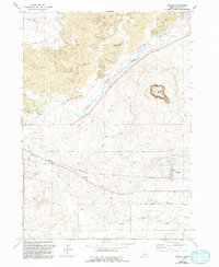
The town of Dietrich serves as the focal point for this 1971 survey, illustrating a landscape defined by the careful management of water across volcanic terrain. The Union Pacific railroad cuts a diagonal path through the region, running parallel to the Milner Gooding Canal and providing a vital transport corridor for the community. The topography is dominated by expansive Lava fields and the prominent Crater Butte, a distinct volcanic landmark rising above the surrounding flats.
Find a feature on this map
20 named features on this map. Tap any name to fly to it.
Don’t see what you’re looking for? This feature index may not catch every label — zoom into the map to look around manually.
Map Details
Editions of this 1971 Dietrich Map
2 editions found
Other maps of this area

1955 · Twin Falls
USGS Topo · 1:250,000

1955 · Hailey
USGS Topo · 1:250,000

1958 · Twin Falls
USGS Topo · 1:250,000

1959 · Hailey
USGS Topo · 1:250,000

1962 · Hailey
USGS Topo · 1:250,000

1971 · Shoshone SE
USGS Topo · 1:24,000

1971 · Star Lake
USGS Topo · 1:24,000
1971 · Shoshone SW
USGS Topo · 1:24,000

1971 · Dietrich Butte
USGS Topo · 1:24,000
1971 · Shoshone
USGS Topo · 1:24,000