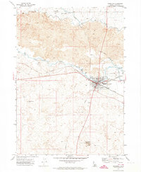
1971 Map of Shoshone
USGS Topo · Published 1974About this map
Shoshone sits at the heart of this high-desert landscape, where the Big Wood River and Little Wood River converge amidst extensive lava fields. The settlement serves as a critical transportation and irrigation hub, defined by the Union Pacific railroad lines and an intricate network of water management features, including the Milner Gooding Canal, a large Diversion Dam, and several flumes and siphons. These engineering works brought life to the arid terrain, supporting local ranching and agriculture alongside features like the Arkoosh Wendell Well.
Find a feature on this map
24 named features on this map. Tap any name to fly to it.
Don’t see what you’re looking for? This feature index may not catch every label — zoom into the map to look around manually.
Map Details
Editions of this 1971 Shoshone Map
3 editions found
Other maps of this area

1955 · Twin Falls
USGS Topo · 1:250,000

1955 · Hailey
USGS Topo · 1:250,000

1957 · Thorn Creek SE
USGS Topo · 1:24,000

1957 · Thorn Creek
USGS Topo · 1:62,500

1958 · Twin Falls
USGS Topo · 1:250,000

1959 · Hailey
USGS Topo · 1:250,000

1962 · Hailey
USGS Topo · 1:250,000

1971 · Shoshone SE
USGS Topo · 1:24,000

1971 · Dietrich
USGS Topo · 1:24,000

1971 · Tunupa
USGS Topo · 1:24,000