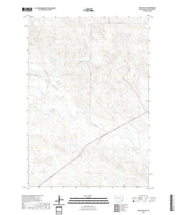
2021 Map of Owl Butte NE
USGS Topo · Published 2021About this map
Sulphur Cr and its associated drainages define the landscape of this corner of Butte County, where the high plains of western South Dakota are carved by a network of intermittent waterways. This modern survey illustrates a rural ranching territory structured by long-established section lines and a sparse network of gravel roads. The intersection of US Route 212 and Gruwell Rd provides the primary transit corridor through a region dominated by open rangeland and the subtle relief of unnamed buttes. Traces of early movement through the territory are visible in the layout of roads like Old Twilight Rd and Mud Butte Rd, which connect remote homesteads and grazing allotments. The mapping of Trail Cr and Doody Cr reflects the critical importance of water management in this arid environment, showing the drainage patterns that have dictated local land use for generations.
Find a feature on this map
14 named features on this map. Tap any name to fly to it.
Don’t see what you’re looking for? This feature index may not catch every label — zoom into the map to look around manually.
Map Details
Editions of this 2021 Owl Butte NE Map
This is the sole edition of this map. No revisions or reprints were ever made.
Other maps of this area

1913 · Newell
USGS Topo · 1:125,000

1935 · Hoover
USGS Topo · 1:125,000

1953 · Rapid City
USGS Topo · 1:250,000

1954 · Lemmon
USGS Topo · 1:250,000

1957 · Lemmon
USGS Topo · 1:250,000

1957 · Rapid City
USGS Topo · 1:250,000
1973 · Deers Ears Butte North
USGS Topo · 1:24,000
1973 · Owl Butte
USGS Topo · 1:24,000
1977 · Deers Ears Butte South
USGS Topo · 1:24,000

1977 · Table Top Butte
USGS Topo · 1:24,000