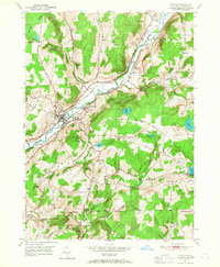
1949 Map of Oxford
USGS Topo · Published 1967About this map
The Chenango River valley serves as a bustling corridor for transportation and public institutions in this 1940s portrait of Chenango County. The village of Oxford is the primary hub, situated where the Delaware Lackawanna and Western Railroad meets the river. Along the valley floor, traces of older infrastructure are visible via the Abandoned Canal, running parallel to the newer rail lines and the New York Ontario and Western Railroad.
Find a feature on this map
48 named features on this map. Tap any name to fly to it.
Don’t see what you’re looking for? This feature index may not catch every label — zoom into the map to look around manually.
Map Details
Editions of this 1949 Oxford Map
This is the sole edition of this map. No revisions or reprints were ever made.
Other maps of this area

1902 · Coventry
USGS Topo · 1:62,500

1903 · Norwich
USGS Topo · 1:62,500

1904 · Oxford
USGS Topo · 1:62,500

1910 · New Berlin
USGS Topo · 1:62,500

1912 · New Berlin
USGS Topo · 1:62,500

1915 · Unadilla
USGS Topo · 1:62,500

1918 · Unadilla
USGS Topo · 1:62,500

1943 · Sidney
USGS Topo · 1:24,000

1943 · Holmesville
USGS Topo · 1:24,000

1943 · Norwich
USGS Topo · 1:24,000