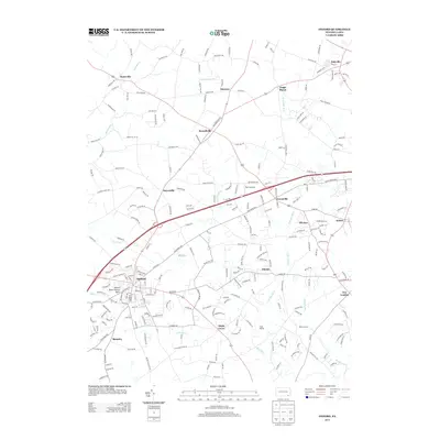
2013 Map of Oxford
USGS Topo · Published 2013About this map
The borough of Oxford serves as the primary hub of this southern Chester County landscape, where the Oxford Press Church Spire stands as a prominent landmark amidst a grid of established streets. The region is defined by the branching waters of the Big Elk Creek system, including the E Br Big Elk Cr and W Br Big Elk Cr, which carve through the terrain near smaller settlements like Elkview and Elkdale. This area maintains a distinct rural character with a dense network of country roads—such as Hog Farm Rd and Pusey Mill Rd—connecting historic locales like Russellville and Faggs Manor. Further south, the map reveals communal and recreational spaces like Camp Saginaw along Big Elk Cr, while the village of New London anchors the eastern edge. The topography is marked by notable elevations such as Slate Hill, providing a detailed look at the geographic transition between traditional Pennsylvania farmsteads and growing residential pockets.
Find a feature on this map
237 named features on this map. Tap any name to fly to it.
Don’t see what you’re looking for? This feature index may not catch every label — zoom into the map to look around manually.
Map Details
Editions of this 2013 Oxford Map
This is the sole edition of this map. No revisions or reprints were ever made.
Other maps of this area

1898 · Elkton
USGS Topo · 1:62,500

1900 · Elkton
USGS Topo · 1:62,500

1900 · Havre De Grace
USGS Topo · 1:62,500

1904 · Coatesville
USGS Topo · 1:62,500

1906 · Coatesville
USGS Topo · 1:62,500

1912 · Quarryville
USGS Topo · 1:62,500

1917 · Elkton
USGS Topo · 1:62,500

1918 · Coatesville
USGS Topo · 1:62,500

1942 · Havre De Grace
USGS Topo · 1:62,500

1942 · Elkton
USGS Topo · 1:62,500
Featured Places
- New London Township, PA
- Londonderry Township, PA
- Upper Oxford Township, PA
- Elk Township, PA
- Sadsbury Township, PA