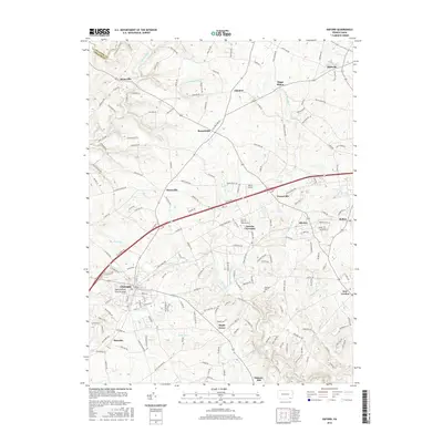
2016 Map of Oxford
USGS Topo · Published 2016About this map
The borough of Oxford serves as a primary hub in this southern Chester County landscape, where the Oxford Press Church Spire marks the skyline. The area is defined by a dense network of hamlets and rural crossroads such as Russellville, Hayesville, and Faggs Manor. Significant institutional history is centered at the Lincoln Univ of Pennsylvania, located near the settlement of Lincoln University. The terrain is deeply etched by the drainage systems of Big Elk Creek and Little Elk Creek, which create a series of ridges and valleys that have historically dictated the placement of roads like Old Limestone Rd and Faggs Manor Rd. Smaller communities such as New London and Kelton are connected by these winding routes, reflecting an enduring agricultural and residential pattern that has persisted even as modern developments like Harris Airport appear.
Find a feature on this map
181 named features on this map. Tap any name to fly to it.
Don’t see what you’re looking for? This feature index may not catch every label — zoom into the map to look around manually.
Map Details
Editions of this 2016 Oxford Map
This is the sole edition of this map. No revisions or reprints were ever made.
Other maps of this area

1898 · Elkton
USGS Topo · 1:62,500

1900 · Elkton
USGS Topo · 1:62,500

1900 · Havre De Grace
USGS Topo · 1:62,500

1904 · Coatesville
USGS Topo · 1:62,500

1906 · Coatesville
USGS Topo · 1:62,500

1912 · Quarryville
USGS Topo · 1:62,500

1917 · Elkton
USGS Topo · 1:62,500

1918 · Coatesville
USGS Topo · 1:62,500

1942 · Havre De Grace
USGS Topo · 1:62,500

1942 · Elkton
USGS Topo · 1:62,500
Featured Places
- New London Township, PA
- Londonderry Township, PA
- Upper Oxford Township, PA
- Elk Township, PA
- Sadsbury Township, PA