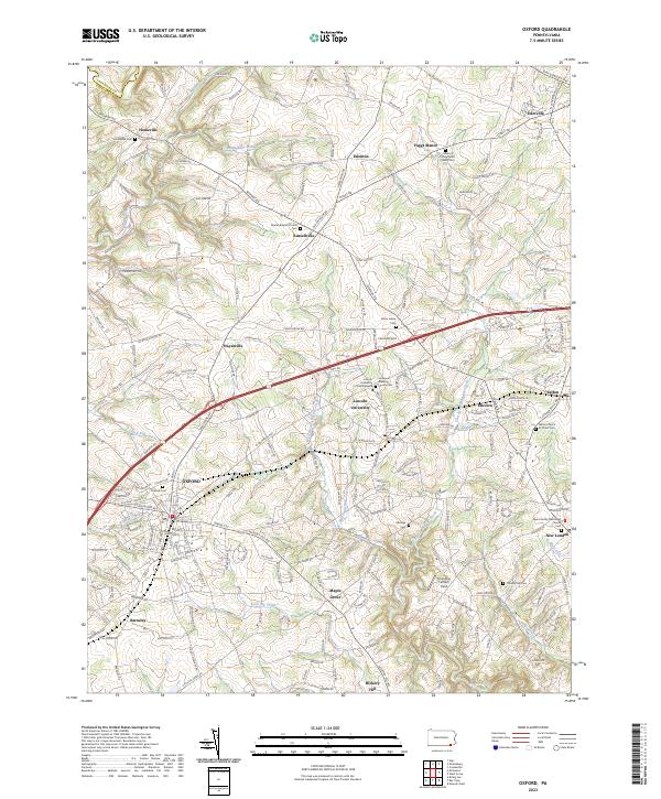
2023 Map of Oxford
USGS Topo · Published 2023About this map
The rolling hills of southern Chester County define this landscape, where the historic Lincoln University campus stands as a prominent cultural landmark between Hayesville and Kelton. A dense network of colonial-era routes like Newark Rd and Street Rd connect established 18th and 19th-century settlements, including the borough of Oxford and the village of New London. This 2023 survey illustrates the enduring agricultural and educational character of the region, anchored by numerous country houses of worship and burial grounds such as the Manor Presbyterian Church Cem and the Hosanna Meeting House.
Find a feature on this map
129 named features on this map. Tap any name to fly to it.
Don’t see what you’re looking for? This feature index may not catch every label — zoom into the map to look around manually.
Map Details
Editions of this 2023 Oxford Map
This is the sole edition of this map. No revisions or reprints were ever made.
Other maps of this area

1898 · Elkton
USGS Topo · 1:62,500

1900 · Elkton
USGS Topo · 1:62,500

1900 · Havre De Grace
USGS Topo · 1:62,500

1904 · Coatesville
USGS Topo · 1:62,500

1906 · Coatesville
USGS Topo · 1:62,500

1912 · Quarryville
USGS Topo · 1:62,500

1917 · Elkton
USGS Topo · 1:62,500

1918 · Coatesville
USGS Topo · 1:62,500

1942 · Havre De Grace
USGS Topo · 1:62,500

1942 · Elkton
USGS Topo · 1:62,500
Featured Places
- New London Township, PA
- Londonderry Township, PA
- Upper Oxford Township, PA
- Penn Township, PA
- West Fallowfield Township, PA