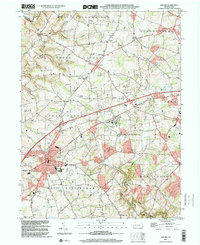
1999 Map of Oxford
USGS Topo · Published 2001About this map
Lincoln University anchors this portion of southern Chester County, sitting near the crossroads of Baltimore Pike and the West Branch McDonald Run. This late 20th-century landscape is defined by its educational and religious heritage, as seen in the density of local schoolhouses such as Oak Grove Sch, Buena Vista Sch, and Elkview Sch. The region shows a transition from agricultural foundations to more modern infrastructure, including a Landing Strip near New London and a Radio Tower in Lower Oxford. Local genealogy is well-represented through historic grounds like Faggs Manor Cem and Beulah Cem. The drainage patterns of Elk Creek and Rattlesnake Run illustrate the rolling topography that directed the early settlement of villages like Russellville, Edenton, and Hayesville along established ridges and watercourses.
Find a feature on this map
60 named features on this map. Tap any name to fly to it.
Don’t see what you’re looking for? This feature index may not catch every label — zoom into the map to look around manually.
Map Details
Editions of this 1999 Oxford Map
This is the sole edition of this map. No revisions or reprints were ever made.
Other maps of this area

1898 · Elkton
USGS Topo · 1:62,500

1900 · Elkton
USGS Topo · 1:62,500

1900 · Havre De Grace
USGS Topo · 1:62,500

1904 · Coatesville
USGS Topo · 1:62,500

1906 · Coatesville
USGS Topo · 1:62,500

1912 · Quarryville
USGS Topo · 1:62,500

1917 · Elkton
USGS Topo · 1:62,500

1918 · Coatesville
USGS Topo · 1:62,500

1942 · Havre De Grace
USGS Topo · 1:62,500

1942 · Elkton
USGS Topo · 1:62,500
Featured Places
- New London Township, PA
- Upper Oxford Township, PA
- Russellville, Upper Oxford Township
- Lower Oxford Township, PA
- East Nottingham Township, PA