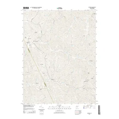
2014 Map of Oxford
USGS Topo · Published 2014About this map
Oxford sits at the northern edge of this West Virginia landscape, where the S Fork Hughes River and its various tributaries carve through the steep topography of the Ritchie and Doddridge county line. The settlement pattern here is dictated by narrow valleys, with small communities like Summers and Holbrook clustered near water crossings and creek bends. For researchers, the map provides a look at the distribution of family-named landmarks and rural burial grounds, such as Nutter Cem, Clevenger Cem, and Hart Cem, which are scattered across the ridgelines and hollows.
Find a feature on this map
80 named features on this map. Tap any name to fly to it.
Don’t see what you’re looking for? This feature index may not catch every label — zoom into the map to look around manually.
Map Details
Editions of this 2014 Oxford Map
This is the sole edition of this map. No revisions or reprints were ever made.
Other maps of this area

1904 · Vadis
USGS Topo · 1:62,500

1905 · Centerpoint
USGS Topo · 1:62,500

1905 · West Union
USGS Topo · 1:62,500

1906 · Holbrook
USGS Topo · 1:62,500

1924 · Centerpoint
USGS Topo · 1:62,500

1924 · West Union
USGS Topo · 1:62,500

1924 · Holbrook
USGS Topo · 1:62,500

1925 · Centerpoint
USGS Topo · 1:62,500

1925 · Vadis
USGS Topo · 1:62,500

1926 · Holbrook
USGS Topo · 1:62,500