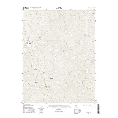
2016 Map of Oxford
USGS Topo · Published 2016About this map
The border of Doddridge Co and Ritchie Co runs through this section of the West Virginia highlands, where the S Fork Hughes River and its numerous tributaries like Middle Fork carve a complex landscape of ridges and hollows. Small rural communities such as Oxford and Holbrook serve as anchors in a region defined by its narrow valleys and prominent landforms, including Wilson Ridge and Maxwell Ridge. The map reveals a high density of family and community burial grounds, such as Nutter Cem, Michaels Cem, and the South Branch East Cem, which are vital for genealogical research in this part of the state. These sites, along with landmarks like the Holbrook Bridge, indicate a long-standing pattern of dispersed settlement connected by winding secondary routes such as Co Rte 19 and Oxford Rd.
Find a feature on this map
86 named features on this map. Tap any name to fly to it.
Don’t see what you’re looking for? This feature index may not catch every label — zoom into the map to look around manually.
Map Details
Editions of this 2016 Oxford Map
This is the sole edition of this map. No revisions or reprints were ever made.
Other maps of this area

1904 · Vadis
USGS Topo · 1:62,500

1905 · Centerpoint
USGS Topo · 1:62,500

1905 · West Union
USGS Topo · 1:62,500

1906 · Holbrook
USGS Topo · 1:62,500

1924 · Centerpoint
USGS Topo · 1:62,500

1924 · West Union
USGS Topo · 1:62,500

1924 · Holbrook
USGS Topo · 1:62,500

1925 · Centerpoint
USGS Topo · 1:62,500

1925 · Vadis
USGS Topo · 1:62,500

1926 · Holbrook
USGS Topo · 1:62,500