
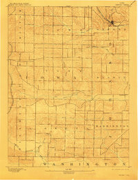
1894 Map of Oxford
USGS Topo · Published 1894About this map
Oxford stands as a primary hub of activity in this nineteenth-century Iowa landscape, positioned at a critical junction of the Chicago Rock Island and Pacific Railroad. The rail line cuts through the northern townships, contrasting with the more isolated settlement of Windham to the southeast. Much of the terrain is defined by a dense network of watercourses, including the central Old Mans Creek and its North Branch, which drain the rolling agricultural lands of Johnson County.
Find a feature on this map
22 named features on this map. Tap any name to fly to it.
Don’t see what you’re looking for? This feature index may not catch every label — zoom into the map to look around manually.
Map Details
Editions of this 1894 Oxford Map
2 editions found
Other maps of this area

1887 · Cedar Rapids
USGS Topo · 1:62,500

1888 · Amana
USGS Topo · 1:62,500

1889 · Amana
USGS Topo · 1:62,500

1891 · Oxford
USGS Topo · 1:62,500

1891 · Cedar Rapids
USGS Topo · 1:62,500

1891 · Iowa City
USGS Topo · 1:62,500

1899 · Amana
USGS Topo · 1:62,500

1903 · Fairfax
USGS Topo · 1:125,000

1938 · Iowa City
USGS Topo · 1:62,500

1954 · Des Moines
USGS Topo · 1:250,000