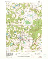
1979 Map of Oxford
USGS Topo · Published 1990About this map
The village of Oxford serves as the focal point of this Central Wisconsin survey, situated at the junction of the Chicago and North Western railway and the waters of Neenah Lake. The landscape is defined by its complex glacial hydrology, featuring a dense network of kettle lakes such as Oxford Lake, Emrick Lake, and Wolf Lake. Land use reflects a balance of small-scale agriculture and conservation, notably within the Upper Neenah Creek State Fishery Area. Transportation routes like Fox Road and Fern Road connect scattered homesteads and local institutions, including the Townhall in Westfield and the Oak Hill Cem. This record of the Adams Co Marquette Co border reveals a rural economy tied to the land, from the localized gravel extraction at the Gravel Pit to the small-scale aviation at Olson Landing Field.
Find a feature on this map
42 named features on this map. Tap any name to fly to it.
Don’t see what you’re looking for? This feature index may not catch every label — zoom into the map to look around manually.
Map Details
Editions of this 1979 Oxford Map
2 editions found
Other maps of this area

1902 · Portage
USGS Topo · 1:62,500

1902 · Briggsville
USGS Topo · 1:62,500

1957 · Madison
USGS Topo · 1:250,000

1958 · Briggsville
USGS Topo · 1:62,500

1960 · Madison
USGS Topo · 1:250,000

1961 · Oxford
USGS Topo · 1:62,500

1961 · Montello
USGS Topo · 1:62,500

1962 · Portage
USGS Topo · 1:62,500
1975 · Big Spring
USGS Topo · 1:24,000
1975 · Briggsville
USGS Topo · 1:24,000