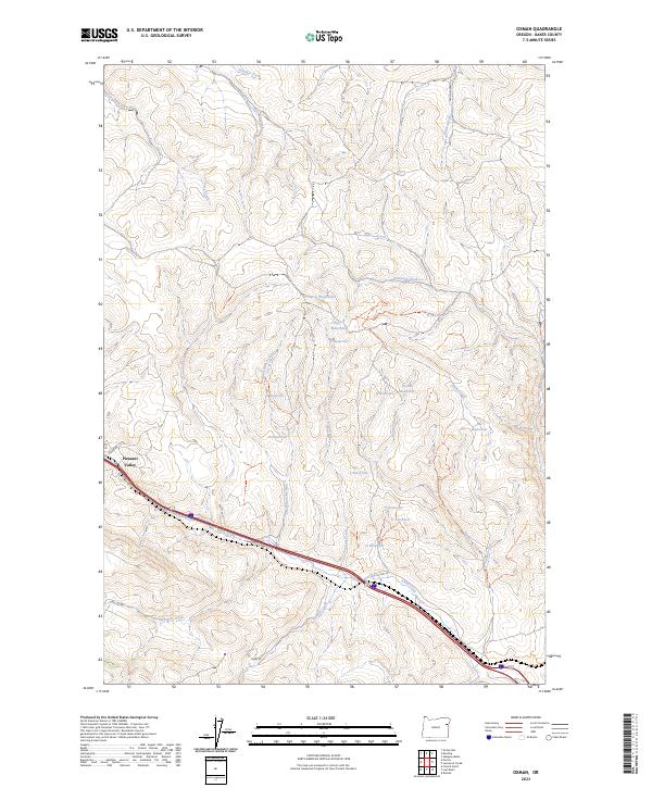
2023 Map of Oxman
USGS Topo · Published 2023About this map
Pleasant Valley sits at the southwestern edge of this landscape, positioned along the historic corridor of Old Us Hwy 30. This area of Baker County is defined by a dense network of high-desert drainages and small-scale water management features. The terrain is marked by numerous family-named and lettered reservoirs, such as Wendt Reservoir and A Reservoir, which support ranching operations in a dry environment. The importance of reliable water sources is evident in the mapping of specific points like Pierce Waterhole, Truscot Waterhole, and Ant Waterhole.
Find a feature on this map
37 named features on this map. Tap any name to fly to it.
Don’t see what you’re looking for? This feature index may not catch every label — zoom into the map to look around manually.
Map Details
Editions of this 2023 Oxman Map
This is the sole edition of this map. No revisions or reprints were ever made.
Other maps of this area

1901 · Baker City
USGS Topo · 1:125,000

1915 · Pine
USGS Topo · 1:125,000

1955 · Baker
USGS Topo · 1:250,000

1957 · Sparta
USGS Topo · 1:62,500

1957 · Durkee
USGS Topo · 1:62,500

1959 · Baker
USGS Topo · 1:250,000

1967 · Virtue Flat
USGS Topo · 1:24,000

1967 · Encina
USGS Topo · 1:24,000
1967 · Keating
USGS Topo · 1:24,000

1967 · French Gulch
USGS Topo · 1:24,000