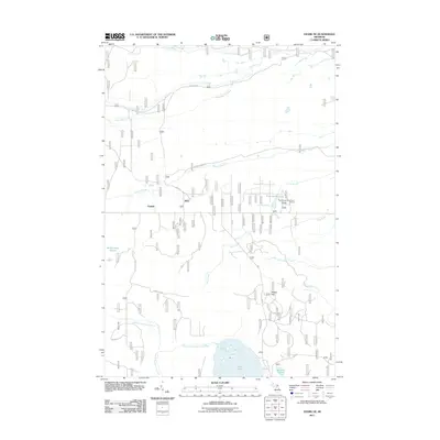
2011 Map of Ozark NE
USGS Topo · Published 2011About this map
Cordell and Dick anchor this portion of the eastern Upper Peninsula, where the landscape is defined by an intricate network of waterways and wetlands. The drainage patterns of the North Branch Carp River and the East Lake Branch Carp River converge near the southern edge of the sheet, feeding into East Lake and Guard Lake. To the west, the expansive Schlehubers Marsh illustrates the low-lying, poorly drained terrain characteristic of the region.
Find a feature on this map
27 named features on this map. Tap any name to fly to it.
Don’t see what you’re looking for? This feature index may not catch every label — zoom into the map to look around manually.
Map Details
Editions of this 2011 Ozark NE Map
This is the sole edition of this map. No revisions or reprints were ever made.
Other maps of this area

1931 · Ozark SE
USGS Topo · 1:31,680

1941 · Strongs
USGS Topo · 1:63,360

1941 · Brimley
USGS Topo · 1:63,360

1951 · Strongs
USGS Topo · 1:24,000

1951 · Sullivan Creek
USGS Topo · 1:24,000

1951 · Raco
USGS Topo · 1:24,000

1951 · Brimley
USGS Topo · 1:62,500

1951 · Strongs
USGS Topo · 1:62,500

1953 · Fibre
USGS Topo · 1:24,000

1954 · Sault Sainte Marie
USGS Topo · 1:250,000