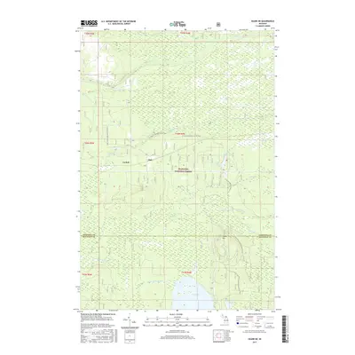
2017 Map of Ozark NE
USGS Topo · Published 2017About this map
The Hiawatha National Forest dominates this section of the Upper Peninsula, where the border between Chippewa and Mackinac counties cuts through a complex network of wetlands and waterways. The northern landscape is defined by the winding course of the Pine River and its tributaries like Blind Biscuit Cr, while the southern reaches are characterized by larger bodies of water including East Lake and Guard Lake. Evidence of small-scale settlement persists at Cordell and Dick, though the region is primarily managed for conservation and recreation. The N Country National Scenic Trail meanders across the terrain, passing through hardwood and evergreen stands near landmarks such as The Big Spring and Maple Hill. This survey highlights the intricate drainage patterns of the eastern UP, tracing the headwaters of the N Br Carp River and the E Lake Br Carp River.
Find a feature on this map
26 named features on this map. Tap any name to fly to it.
Don’t see what you’re looking for? This feature index may not catch every label — zoom into the map to look around manually.
Map Details
Editions of this 2017 Ozark NE Map
This is the sole edition of this map. No revisions or reprints were ever made.
Other maps of this area

1931 · Ozark SE
USGS Topo · 1:31,680

1941 · Strongs
USGS Topo · 1:63,360

1941 · Brimley
USGS Topo · 1:63,360

1951 · Strongs
USGS Topo · 1:24,000

1951 · Sullivan Creek
USGS Topo · 1:24,000

1951 · Raco
USGS Topo · 1:24,000

1951 · Brimley
USGS Topo · 1:62,500

1951 · Strongs
USGS Topo · 1:62,500

1953 · Fibre
USGS Topo · 1:24,000

1954 · Sault Sainte Marie
USGS Topo · 1:250,000