1980 Map of Ozone
USGS Topo · Published 1980About this map
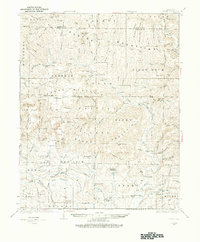
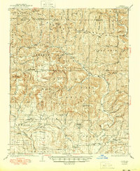
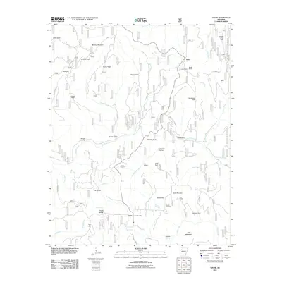
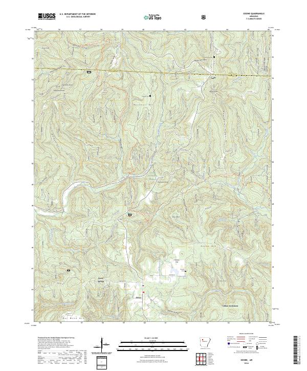
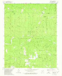
Ozone and Salus are the primary settlements within this section of the Ozark National Forest as it was documented in 1980. The landscape is defined by the Mulberry River and Big Piney Creek, with the terrain rising to prominent heights at Ozone Mountain and Moonhull Mountain. This era shows a community structured around small country churches and cemeteries, such as the Miracle Temple Ch and Pine Grove Cem. Cultural geography is preserved through family-named landmarks like Johnson Point, Gillian Settlement, and Thompson Knob. The map also captures infrastructure from the late 1970s, including the Devils Knob Lookout Tower and a Gas Well in the southwest corner near Dry Spadra Creek. Local transit is guided by roads like Low Gap Road and Porter Road, which wind through various hollows and ridges that characterize this part of Johnson and Newton counties.
Find a feature on this map
53 named features on this map. Tap any name to fly to it.
Don’t see what you’re looking for? This feature index may not catch every label — zoom into the map to look around manually.
Map Details
Editions of this 1980 Ozone Map
This is the sole edition of this map. No revisions or reprints were ever made.
Historical Maps of Hickory Flat Through Time
9 maps found