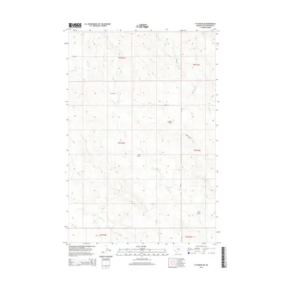
2014 Map of P K Ranch NE
USGS Topo · Published 2014About this map
Lookout Point rises above a landscape defined by deep drainages and rural corridors in this section of Yellowstone County. The map details the winding paths of Hibbard Cr, Cow Gulch, and Railroad Cr, illustrating the complex water patterns that have historically shaped land use and livestock movement in this part of Montana. Surveyed by the U.S. Geological Survey, the document highlights the intersection of several townships, including t5n r29e and t6n r30e, which partition the territory into large-scale ranching and grazing tracts. Grounded in the early 21st century, the map provides a clear view of the established road network, featuring Huffine Rd, Bundy Rd, and Hibbard Creek Rd, which link the high-elevation vantage points to the creek bottoms below.
Find a feature on this map
13 named features on this map. Tap any name to fly to it.
Don’t see what you’re looking for? This feature index may not catch every label — zoom into the map to look around manually.
Map Details
Editions of this 2014 P K Ranch NE Map
This is the sole edition of this map. No revisions or reprints were ever made.
Other maps of this area

1954 · Forsyth
USGS Topo · 1:250,000

1954 · Roundup
USGS Topo · 1:250,000

1957 · Forsyth
USGS Topo · 1:250,000

1958 · Roundup
USGS Topo · 1:250,000

1958 · Forsyth
USGS Topo · 1:250,000
1967 · Big Marys Island
USGS Topo · 1:24,000

1979 · Roundup
USGS Topo · 1:100,000

1979 · Hysham
USGS Topo · 1:100,000
1980 · P K Ranch NE
USGS Topo · 1:24,000
1980 · Bull Mountain NW
USGS Topo · 1:24,000