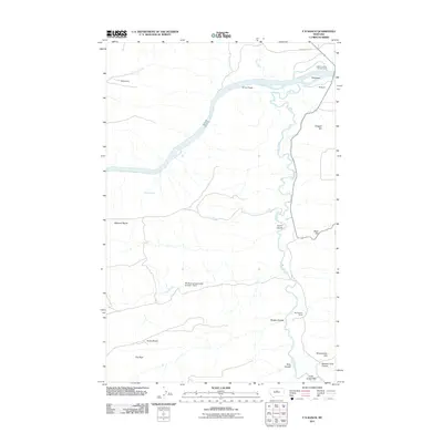
2011 Map of P N Ranch
USGS Topo · Published 2011About this map
Old Fort Clagget stands near the strategic confluence where the Judith River meets the Missouri River, marking a landscape deeply tied to frontier commerce and early Montana ranching. This 2011 survey documents a region defined by massive geographic features like the Missouri Bench and Evers Bench, which rise above the river valleys. The presence of the PN Ranch and Seventynine Ranch reflects the enduring legacy of large-scale cattle operations in Fergus County. Notable landmarks such as Hole-in-the-Wall and Clagget Hill provide specific points of interest for those tracking local history or geographic changes over time. Water management for the high-plains environment is evident through structures like Moes Dam and the PN Grazing Association Number 1 Dam, which support the agricultural life of the area alongside the Judith Landing Campground.
Find a feature on this map
23 named features on this map. Tap any name to fly to it.
Don’t see what you’re looking for? This feature index may not catch every label — zoom into the map to look around manually.
Map Details
Editions of this 2011 P N Ranch Map
This is the sole edition of this map. No revisions or reprints were ever made.
Other maps of this area

1953 · Starve Out Flat
USGS Topo · 1:24,000

1954 · P N Ranch
USGS Topo · 1:24,000

1954 · Iliad
USGS Topo · 1:24,000

1954 · Council Island
USGS Topo · 1:24,000

1954 · Lewistown
USGS Topo · 1:250,000

1959 · Lewistown
USGS Topo · 1:250,000

1964 · Wolf Creek Falls
USGS Topo · 1:24,000

1964 · Pigtail Coulee
USGS Topo · 1:24,000

1964 · Anderson Bridge
USGS Topo · 1:24,000

1964 · Spring Coulee
USGS Topo · 1:24,000