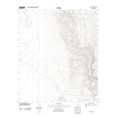
2011 Map of P X Flat
USGS Topo · Published 2011About this map
P X Flat and the surrounding high desert of Culberson County define this landscape near the New Mexico border. The terrain is characterized by dramatic elevation changes, moving from the low expanse of Crow Flats in the northwest to the prominent peaks of the Brokeoff Mountains and Blue Ridge. This area contains vital water sources in an arid environment, including Goat Spring, Cox Tank, and the intermittent Bone Spring Draw. Settlement is sparse, represented primarily by Williams Ranch in the southeast corner. The presence of the Kincaid Trl traversing the rugged slopes of Bush Mountain and Bartlett Peak suggests a land managed for ranching and limited transit, where life is dictated by the availability of water and the steep canyons like Bone Canyon.
Find a feature on this map
19 named features on this map. Tap any name to fly to it.
Don’t see what you’re looking for? This feature index may not catch every label — zoom into the map to look around manually.
Map Details
Editions of this 2011 P X Flat Map
This is the sole edition of this map. No revisions or reprints were ever made.
Other maps of this area

1933 · Guadalupe Peak
USGS Topo · 1:48,000

1935 · El Paso Gap
USGS Topo · 1:62,500

1936 · El Paso Gap
USGS Topo · 1:48,000

1940 · El Paso Gap
USGS Topo · 1:62,500

1940 · Guadalupe Peak
USGS Topo · 1:62,500

1951 · Dell City
USGS Topo · 1:62,500

1954 · Carlsbad
USGS Topo · 1:250,000

1954 · Van Horn
USGS Topo · 1:250,000

1958 · Van Horn
USGS Topo · 1:250,000

1958 · Carlsbad
USGS Topo · 1:250,000