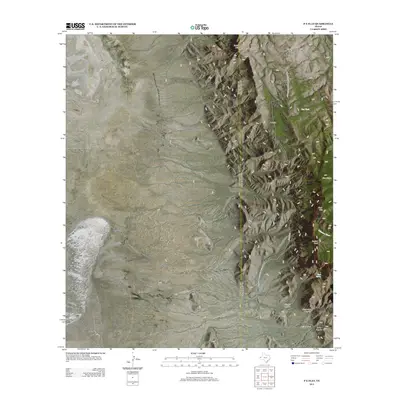
2013 Map of P X Flat
USGS Topo · Published 2013About this map
Guadalupe Mountains National Park dominates the eastern half of this terrain, where the high ridges of the Trans-Pecos give way to the sprawling scrublands of P X Flat. The landscape is defined by dramatic verticality, as prominent summits like Bush Mtn and Bartlett Peak overlook deep geological cuts including Shumard Canyon and Bone Canyon. Water is the scarcest resource here, marked only by isolated points like Goat Spring and Cox Tank, which have historically dictated human movement through these arid corridors. Human activity is sparse and concentrated along the periphery, with the Kincaid Trl and Williams Ranch providing the few markers of habitation and passage in an area where the Delaware River serves as a primary drainage for the surrounding mountains.
Find a feature on this map
16 named features on this map. Tap any name to fly to it.
Don’t see what you’re looking for? This feature index may not catch every label — zoom into the map to look around manually.
Map Details
Editions of this 2013 P X Flat Map
This is the sole edition of this map. No revisions or reprints were ever made.
Other maps of this area

1933 · Guadalupe Peak
USGS Topo · 1:48,000

1935 · El Paso Gap
USGS Topo · 1:62,500

1936 · El Paso Gap
USGS Topo · 1:48,000

1940 · El Paso Gap
USGS Topo · 1:62,500

1940 · Guadalupe Peak
USGS Topo · 1:62,500

1951 · Dell City
USGS Topo · 1:62,500

1954 · Carlsbad
USGS Topo · 1:250,000

1954 · Van Horn
USGS Topo · 1:250,000

1958 · Van Horn
USGS Topo · 1:250,000

1958 · Carlsbad
USGS Topo · 1:250,000