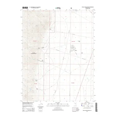
2014 Map of Pablo Canyon Ranch
USGS Topo · Published 2014About this map
Big Smoky Valley floor meets the high ridges of the Toiyabe National Forest in this 2014 survey. The settlement of Hadley serves as a modern focal point, featuring a residential grid with named streets like Prospect Ave and Electrum Dr, alongside the Hadley Airport. This area is characterized by the transition from the flat valley floor to the steep, canyon-riven slopes to the west.
Find a feature on this map
45 named features on this map. Tap any name to fly to it.
Don’t see what you’re looking for? This feature index may not catch every label — zoom into the map to look around manually.
Map Details
Editions of this 2014 Pablo Canyon Ranch Map
This is the sole edition of this map. No revisions or reprints were ever made.
Other maps of this area

1907 · Tonopah
USGS Topo · 1:250,000

1908 · Tonopah
USGS Topo · 1:250,000

1956 · Tonopah
USGS Topo · 1:250,000

1959 · Tonopah
USGS Topo · 1:250,000

1962 · Tonopah
USGS Topo · 1:250,000

1971 · Carvers
USGS Topo · 1:24,000

1971 · Seyler Peak
USGS Topo · 1:24,000

1971 · Manhattan
USGS Topo · 1:24,000

1971 · Pablo Canyon Ranch
USGS Topo · 1:24,000
1971 · Carvers SE
USGS Topo · 1:24,000