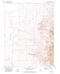
1971 Map of Carvers SE
USGS Topo · Published 1975About this map
Big Smoky Valley (Depression) defines the western half of this Nevada landscape, where the alluvial fans transition into the high elevations of the Toiyabe National Forest. The 1971 field check captures a period of modest industrial activity along the eastern foothills, notably at the Gold Hill Mill and a nearby Prospect. These features, along with localized Tailings, point to the enduring mineral interest in this remote section of Nye County.
Find a feature on this map
15 named features on this map. Tap any name to fly to it.
Don’t see what you’re looking for? This feature index may not catch every label — zoom into the map to look around manually.
Map Details
Editions of this 1971 Carvers SE Map
This is the sole edition of this map. No revisions or reprints were ever made.
Other maps of this area

1907 · Tonopah
USGS Topo · 1:250,000

1908 · Tonopah
USGS Topo · 1:250,000

1956 · Tonopah
USGS Topo · 1:250,000

1959 · Tonopah
USGS Topo · 1:250,000

1962 · Tonopah
USGS Topo · 1:250,000

1971 · Carvers NW
USGS Topo · 1:24,000

1971 · Carvers
USGS Topo · 1:24,000
1971 · Jet Spring
USGS Topo · 1:24,000

1971 · Pablo Canyon Ranch
USGS Topo · 1:24,000
1971 · Carvers NE
USGS Topo · 1:24,000