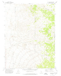
1971 Map of Jet Spring
USGS Topo · Published 1974About this map
Toquima Range peaks and high-elevation springs define this 1970s survey of central Nevada. The landscape is characterized by its isolation and specialized land use, with the Toiyabe National Forest boundary cutting through the high country. Resource extraction is evident in the northern and eastern reaches of the map, where a labeled mine and various prospects suggest the mining history common to this part of Nye County.
Find a feature on this map
9 named features on this map. Tap any name to fly to it.
Don’t see what you’re looking for? This feature index may not catch every label — zoom into the map to look around manually.
Map Details
Editions of this 1971 Jet Spring Map
2 editions found
Other maps of this area

1907 · Tonopah
USGS Topo · 1:250,000

1908 · Tonopah
USGS Topo · 1:250,000

1926 · Roberts Mountains
USGS Topo · 1:250,000

1929 · Roberts Mountains
USGS Topo · 1:250,000

1955 · Millett
USGS Topo · 1:250,000

1956 · Millett Ranch
USGS Topo · 1:62,500

1956 · Tonopah
USGS Topo · 1:250,000

1959 · Tonopah
USGS Topo · 1:250,000

1959 · Millett
USGS Topo · 1:250,000

1960 · Wildcat Peak
USGS Topo · 1:62,500