
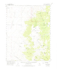
1960 Map of Wildcat Peak
USGS Topo · Published 1962About this map
Smoky Valley dominates the western half of this 1960 survey, a stark contrast to the high elevations of the Toiyabe National Forest that rise sharply to the east. The terrain is marked by a complex network of springs and canyons, such as Stoneberger Canyon and Northumberland Canyon, which provided critical water sources in an arid landscape. Evidence of early land use and transit is found at Indian Ranch and along the various trails and jeep tracks that navigate through Clipper Gap and over Petes Summit. Local industry and curiosity are noted by the Bronco Mine and the significant archaeological site at Toquima Cave. The map provides a detailed view of the Lander and Nye County line as it traverses the high ridges near Wildcat Peak, documenting the remote outposts and natural landmarks central to the region's ranching and mining history.
Find a feature on this map
54 named features on this map. Tap any name to fly to it.
Don’t see what you’re looking for? This feature index may not catch every label — zoom into the map to look around manually.
Map Details
Editions of this 1960 Wildcat Peak Map
2 editions found
Other maps of this area

1907 · Tonopah
USGS Topo · 1:250,000

1908 · Tonopah
USGS Topo · 1:250,000

1926 · Roberts Mountains
USGS Topo · 1:250,000

1929 · Roberts Mountains
USGS Topo · 1:250,000

1955 · Millett
USGS Topo · 1:250,000

1956 · Millett Ranch
USGS Topo · 1:62,500

1956 · Austin
USGS Topo · 1:62,500

1956 · Tonopah
USGS Topo · 1:250,000

1959 · Tonopah
USGS Topo · 1:250,000

1959 · Millett
USGS Topo · 1:250,000