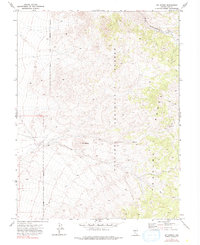
1971 Map of Jet Spring
USGS Topo · Published 1990About this map
The high ridges of the Toquima Range dominate this central Nevada landscape, where the peaks of the Toiyabe National Forest reach toward a distinctive landmark named Mt Ziggurat. This 1971 survey captures a remote wilderness defined by steep relief and a handful of human incursions related to the regional extraction economy. On the eastern slopes, a single Mine and various Prospects indicate the continued interest in the mineral wealth of the high desert, while a network of primitive Jeep Trails provides the only access through the rugged terrain.
Find a feature on this map
9 named features on this map. Tap any name to fly to it.
Don’t see what you’re looking for? This feature index may not catch every label — zoom into the map to look around manually.
Map Details
Editions of this 1971 Jet Spring Map
2 editions found
Other maps of this area

1907 · Tonopah
USGS Topo · 1:250,000

1908 · Tonopah
USGS Topo · 1:250,000

1926 · Roberts Mountains
USGS Topo · 1:250,000

1929 · Roberts Mountains
USGS Topo · 1:250,000

1955 · Millett
USGS Topo · 1:250,000

1956 · Millett Ranch
USGS Topo · 1:62,500

1956 · Tonopah
USGS Topo · 1:250,000

1959 · Tonopah
USGS Topo · 1:250,000

1959 · Millett
USGS Topo · 1:250,000

1960 · Wildcat Peak
USGS Topo · 1:62,500