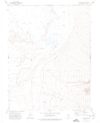
1971 Map of Carvers NE
USGS Topo · Published 1975About this map
Big Smoky Valley (Depression) dominates this high-desert landscape in Nye County, where the valley floor is characterized by an extensive Alkali Flat. The map reveals a sparse but deliberate human footprint centered around water sources, notably at the Charnock Ranch and a nearby Corral. These features represent the essential infrastructure of Great Basin ranching life in the early 1970s, where survival depended on proximity to seasonal flows and established Springs. Drainage patterns are defined by the courses of Moores Creek and Anderson Creek, which descend from higher elevations toward the arid basin floor. The cartography captures the basin-and-range topography with fine contour intervals, illustrating the transition from steep slopes to the level, mineral-crusted surface of the valley.
Find a feature on this map
10 named features on this map. Tap any name to fly to it.
Don’t see what you’re looking for? This feature index may not catch every label — zoom into the map to look around manually.
Map Details
Editions of this 1971 Carvers NE Map
This is the sole edition of this map. No revisions or reprints were ever made.
Other maps of this area

1907 · Tonopah
USGS Topo · 1:250,000

1908 · Tonopah
USGS Topo · 1:250,000

1926 · Roberts Mountains
USGS Topo · 1:250,000

1929 · Roberts Mountains
USGS Topo · 1:250,000

1955 · Millett
USGS Topo · 1:250,000

1956 · Millett Ranch
USGS Topo · 1:62,500

1956 · Tonopah
USGS Topo · 1:250,000

1959 · Tonopah
USGS Topo · 1:250,000

1959 · Millett
USGS Topo · 1:250,000

1960 · Wildcat Peak
USGS Topo · 1:62,500