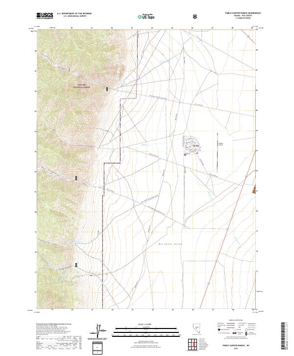
2021 Map of Pablo Canyon Ranch
USGS Topo · Published 2021About this map
Big Smoky Valley serves as the central geographic feature of this Nye County landscape, where the flat basin floor meets the steep eastern slopes of the Toiyabe National Forest. The settlement of Hadley is the primary residential hub, characterized by a concentrated street grid including Smokey Valley Blvd, Electrum Dr, and Hadley Cir. This planned layout, situated adjacent to the Hadley Airport, stands in sharp contrast to the surrounding alluvial fans and deep incisions of Jett Canyon and Pablo Canyon. The transition from the desert valley to the high forest boundary is marked by a network of drainage ways and springs, including Antelope Spring and Boyd Canyon Spring, which historically supported movement through the mountain passes. Modern access is defined by the Fremont Rte and various forest development roads that trace the base of the range, following the natural contours of the mountain front.
Find a feature on this map
45 named features on this map. Tap any name to fly to it.
Don’t see what you’re looking for? This feature index may not catch every label — zoom into the map to look around manually.
Map Details
Editions of this 2021 Pablo Canyon Ranch Map
This is the sole edition of this map. No revisions or reprints were ever made.
Other maps of this area

1907 · Tonopah
USGS Topo · 1:250,000

1908 · Tonopah
USGS Topo · 1:250,000

1956 · Tonopah
USGS Topo · 1:250,000

1959 · Tonopah
USGS Topo · 1:250,000

1962 · Tonopah
USGS Topo · 1:250,000

1971 · Carvers
USGS Topo · 1:24,000

1971 · Seyler Peak
USGS Topo · 1:24,000

1971 · Manhattan
USGS Topo · 1:24,000

1971 · Pablo Canyon Ranch
USGS Topo · 1:24,000
1971 · Carvers SE
USGS Topo · 1:24,000