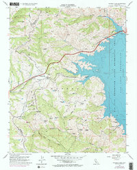
1955 Map of Pacheco Pass
USGS Topo · Published 1972About this map
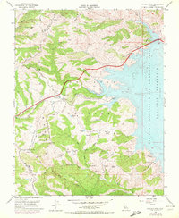
Pacheco Pass serves as the primary corridor through the Diablo Range, bridging the boundary between Santa Clara Co and Merced Co. This 1955 survey, updated in the early 1970s, captures a landscape defined by dramatic elevation changes and a complex network of springs and small lakes. The eastern portion of the map is dominated by the San Luis Reservoir, part of the San Luis Reservoir State Recreation Area, showing the inundation of the valley floor and the resulting shoreline. Away from the water, the terrain is marked by remote landmarks like Whisky Flat and Hagerman Peak. A high density of water sources, including Lucky Spring, Pigs Bath Tub, and Dinosaur Lake, suggests the historical importance of water management for livestock in these upland areas before and after the reservoir's creation.
Find a feature on this map
37 named features on this map. Tap any name to fly to it.
Don’t see what you’re looking for? This feature index may not catch every label — zoom into the map to look around manually.
Map Details
Editions of this 1955 Pacheco Pass Map
5 editions found
Other maps of this area

1919 · Hollister
USGS Topo · 1:48,000

1920 · Pacheco Pass
USGS Topo · 1:62,500

1921 · Gilroy Hot Springs
USGS Topo · 1:62,500

1921 · Hollister
USGS Topo · 1:62,500

1922 · Quien Sabe
USGS Topo · 1:62,500

1922 · San Luis Creek
USGS Topo · 1:31,680

1922 · Howard Ranch
USGS Topo · 1:31,680

1923 · Hollister
USGS Topo · 1:62,500

1939 · Gilroy Hot Springs
USGS Topo · 1:62,500

1940 · Gilroy Hot Springs
USGS Topo · 1:62,500