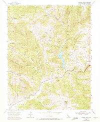
1955 Map of Pacheco Peak
USGS Topo · Published 1972About this map
Bell Station and the Pacheco Ranger Sta serve as central landmarks in this mid-century survey of the Diablo Range. The landscape is defined by the convergence of the North Fork Pacheco Creek and the South Fork Pacheco Creek, which feed into the prominent Pacheco Lake. This area of eastern Santa Clara County is marked by established cattle operations such as Dowdy Ranch, O'Connor Ranch, and Shaeirn Ranch, reflecting a ranching economy that utilized the valleys between Mustang Ridge and Kaufman Ridge. Significant elevation changes are noted at peaks like Pacheco Pk and Burra Burra Peak, while distinctive formations such as Lovers Leap and Elephant Head punctuate the ridges. A network of trails and jeep tracks connects these high points to lower features like Turkey Flat.
Find a feature on this map
51 named features on this map. Tap any name to fly to it.
Don’t see what you’re looking for? This feature index may not catch every label — zoom into the map to look around manually.
Map Details
Editions of this 1955 Pacheco Peak Map
4 editions found

Other maps of this area

1919 · Hollister
USGS Topo · 1:48,000

1920 · Pacheco Pass
USGS Topo · 1:62,500

1921 · Gilroy Hot Springs
USGS Topo · 1:62,500

1921 · Hollister
USGS Topo · 1:62,500

1922 · Quien Sabe
USGS Topo · 1:62,500

1923 · Hollister
USGS Topo · 1:62,500

1939 · Gilroy Hot Springs
USGS Topo · 1:62,500

1940 · Gilroy Hot Springs
USGS Topo · 1:62,500

1940 · Hollister
USGS Topo · 1:62,500

1940 · Pacheco Pass
USGS Topo · 1:62,500