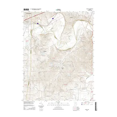
2015 Map of Pacific
USGS Topo · Published 2015About this map
The Meramec River winds through the borderlands where St. Louis, Jefferson, and Franklin Counties meet, anchoring a landscape defined by significant elevation changes and concentrated residential developments. Near the northern bend of the river, the BNSF Railway corridor serves the industrial and transport needs of Pacific and Eureka, while smaller residential enclaves such as Wildwood occupy the higher ridges. The interior of the quadrangle is notably defined by several private water bodies and valley settlements, including Lake Tekawitha and the community of Byrnesville situated along the Big River. Local heritage is anchored by landmarks like St Josephs Ch and its accompanying St Josephs Cem near La Barque Creek, alongside the McNamee Sch, providing clear points of interest for genealogical research in this suburban-rural transition zone.
Find a feature on this map
172 named features on this map. Tap any name to fly to it.
Don’t see what you’re looking for? This feature index may not catch every label — zoom into the map to look around manually.
Map Details
Editions of this 2015 Pacific Map
This is the sole edition of this map. No revisions or reprints were ever made.
Other maps of this area

1901 · De Soto
USGS Topo · 1:125,000

1903 · O'Fallon
USGS Topo · 1:125,000

1930 · Pacific SE
USGS Topo · 1:24,000

1931 · Manchester SE
USGS Topo · 1:24,000

1931 · Pacific NE
USGS Topo · 1:24,000

1937 · Pacific
USGS Topo · 1:24,000

1938 · Cedar Hill
USGS Topo · 1:24,000

1940 · Cedar Hill
USGS Topo · 1:24,000

1940 · Eureka
USGS Topo · 1:24,000

1944 · Eureka
USGS Topo · 1:24,000