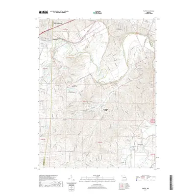
2017 Map of Pacific
USGS Topo · Published 2017About this map
The Meramec River winds through the heart of this landscape, serving as a natural divider between the growing communities of Pacific, Eureka, and Wildwood. This 2017 survey illustrates the complex geography where Franklin, Saint Louis, and Jefferson counties converge. To the south, the winding course of La Barque Creek and the settlement of Byrnesville define a more rural character compared to the residential expansion seen near The Legends Pkwy. Local history and geography enthusiasts can trace the terrain from the elevations of Lost Hill and Bald Hill down to the shores of Lake Tekakwitha and Gem Lake. The map provides a contemporary record of suburban development alongside the persistent natural features of the river valley, including smaller water bodies like Lynch Lake and the educational anchor at Fox School.
Find a feature on this map
176 named features on this map. Tap any name to fly to it.
Don’t see what you’re looking for? This feature index may not catch every label — zoom into the map to look around manually.
Map Details
Editions of this 2017 Pacific Map
This is the sole edition of this map. No revisions or reprints were ever made.
Other maps of this area

1901 · De Soto
USGS Topo · 1:125,000

1903 · O'Fallon
USGS Topo · 1:125,000

1930 · Pacific SE
USGS Topo · 1:24,000

1931 · Manchester SE
USGS Topo · 1:24,000

1931 · Pacific NE
USGS Topo · 1:24,000

1937 · Pacific
USGS Topo · 1:24,000

1938 · Cedar Hill
USGS Topo · 1:24,000

1940 · Cedar Hill
USGS Topo · 1:24,000

1940 · Eureka
USGS Topo · 1:24,000

1944 · Eureka
USGS Topo · 1:24,000