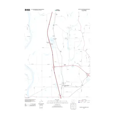
2013 Map of Pacific Junction
USGS Topo · Published 2013About this map
The Missouri River floodplain defines this 2013 topographic survey, where drainage systems like Saint Marys Ditch, Eaton Ditch, and several oxbow-style lakes reflect a landscape shaped by water and engineering. The settlement of Pacific Junction sits at a critical nexus of rail and road infrastructure, while smaller locales like Pacific City, Folsom, and Mills are scattered across the fertile bottoms and rising bluffs. The transition from the low-lying river valley to the rolling hills is marked by distinct topographical features such as Wall Hollow, Indian Hollow, and Boyer Hollow. In addition to its agricultural and residential areas, the map highlights significant managed lands including the Folsom Wildlife Area, which borders Folsom Lake. Along the southern edge, the Plattsmouth Bridge provides a vital connection across the river toward Nebraska, anchoring the regional transport network near the confluence of Keg Cr and other tributaries.
Find a feature on this map
47 named features on this map. Tap any name to fly to it.
Don’t see what you’re looking for? This feature index may not catch every label — zoom into the map to look around manually.
Map Details
Editions of this 2013 Pacific Junction Map
This is the sole edition of this map. No revisions or reprints were ever made.
Other maps of this area

1935 · Nehawka
USGS Topo · 1:48,000

1940 · Nehawka
USGS Topo · 1:62,500

1954 · Omaha
USGS Topo · 1:250,000

1955 · Nebraska City
USGS Topo · 1:250,000

1956 · Glenwood
USGS Topo · 1:24,000

1956 · Mineola
USGS Topo · 1:24,000

1956 · Murray
USGS Topo · 1:24,000

1956 · Rock Bluff
USGS Topo · 1:24,000

1956 · Plattsmouth
USGS Topo · 1:24,000

1956 · Pacific Junction
USGS Topo · 1:24,000