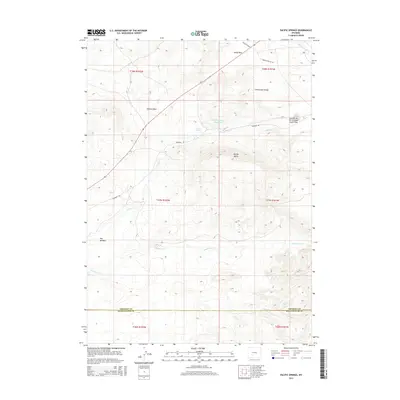
2015 Map of Pacific Springs
USGS Topo · Published 2015About this map
South Pass and the Continental Divide define this high-altitude landscape where the historic western migration routes converged. This survey documents the intersection of several primary trails that shaped the expansion of the American West, including the Emigrant Trl and the Lander Cutoff. The terrain is marked by the presence of vital water sources in an otherwise arid environment, specifically the Pacific Springs and the headwaters of Pacific Cr, which flow westward toward the Pacific Ocean. To the east, the Sweetwater River signifies the opposite drainage, making the Summit of the Original South Pass a critical geographic and cultural waypoint. The map also shows significant natural features like Pacific Butte and the broad Hay Meadow, along with modern developments such as the Pacific Number 1 Reservoir and Oregon Buttes Rd.
Find a feature on this map
21 named features on this map. Tap any name to fly to it.
Don’t see what you’re looking for? This feature index may not catch every label — zoom into the map to look around manually.
Map Details
Editions of this 2015 Pacific Springs Map
This is the sole edition of this map. No revisions or reprints were ever made.
Other maps of this area

1953 · South Pass City
USGS Topo · 1:24,000

1955 · Lander
USGS Topo · 1:250,000

1958 · Lander
USGS Topo · 1:250,000

1958 · Parting of the Ways
USGS Topo · 1:62,500

1958 · Essex Mountain
USGS Topo · 1:62,500

1958 · Hay Meadow Reservoir
USGS Topo · 1:24,000

1958 · Pacific Springs
USGS Topo · 1:24,000

1958 · Freighter Gap
USGS Topo · 1:62,500

1958 · Dickie Springs
USGS Topo · 1:24,000

1961 · Lander
USGS Topo · 1:250,000