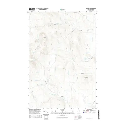
2014 Map of Packard Lake
USGS Topo · Published 2014About this map
Packard Lake and Ketchum Lake sit within a landscape defined by significant timberlands and a complex network of branching waterways in this northern Aroostook County survey. The terrain is marked by prominent elevations such as Nineteen Mtn and Estabrook Hill, which overlook the winding course of the N Br Meduxnekeag River as it moves through the southern reaches of the quadrangle. The spatial arrangement of ridges like Collins Ridge and Chandler Ridge dictates the flow of numerous tributaries, including Number Nine Stream and Three Brooks. Local road networks, including E Plantation Rd and Kinney Rd, trace the valleys and foothills, providing access to these upland areas. This detailed mapping records the hydrography of the region just before the mid-2010s, capturing the specific naming conventions of the small brooks and family-named ridges that define this part of Maine.
Find a feature on this map
35 named features on this map. Tap any name to fly to it.
Don’t see what you’re looking for? This feature index may not catch every label — zoom into the map to look around manually.
Map Details
Editions of this 2014 Packard Lake Map
This is the sole edition of this map. No revisions or reprints were ever made.
Other maps of this area

1934 · Bridgewater
USGS Topo · 1:48,000

1935 · Howe Brook
USGS Topo · 1:48,000

1935 · Presque Isle
USGS Topo · 1:62,500

1936 · Mars Hill
USGS Topo · 1:48,000

1938 · Bridgewater
USGS Topo · 1:62,500

1939 · Howe Brook
USGS Topo · 1:62,500

1940 · Mars Hill
USGS Topo · 1:62,500

1951 · Mars Hill
USGS Topo · 1:62,500

1951 · Bridgewater
USGS Topo · 1:62,500

1953 · Bridgewater
USGS Topo · 1:50,000