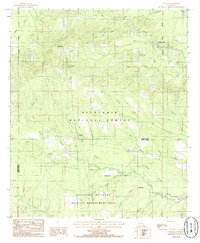
1984 Map of Packton
USGS Topo · Published 1985About this map
Packton and Jordan Hill serve as the primary focal points of this central Louisiana landscape during the mid-1980s. The terrain is characterized by a dense network of watercourses, including the Dugdemona River in the northeast and numerous tributaries such as Big Jordan Creek and Caskey Branch. This region is heavily defined by conservation and forest management, with significant acreage dedicated to the Kisatchie National Forest and the Catahoula National Wildlife Management Area.
Find a feature on this map
29 named features on this map. Tap any name to fly to it.
Don’t see what you’re looking for? This feature index may not catch every label — zoom into the map to look around manually.
Map Details
Editions of this 1984 Packton Map
This is the sole edition of this map. No revisions or reprints were ever made.
Other maps of this area

1932 · Colfax NE
USGS Topo · 1:31,680

1932 · Colfax NW
USGS Topo · 1:31,680

1936 · Colfax
USGS Topo · 1:62,500

1936 · Pollock
USGS Topo · 1:62,500

1941 · Pollock
USGS Topo · 1:62,500

1950 · Winnfield
USGS Topo · 1:62,500

1951 · Winnfield
USGS Topo · 1:62,500

1953 · Alexandria
USGS Topo · 1:250,000

1954 · Tullos
USGS Topo · 1:62,500

1955 · Alexandria
USGS Topo · 1:250,000