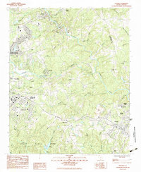
1983 Map of Pacolet
USGS Topo · Published 1983About this map
The Pacolet River snakes through this South Carolina landscape, defining the development of textile communities like Clifton, Glendale, and Pacolet Mills in the early 1980s. The area's industrial and agricultural history is etched into the terrain, where the Southern railroad connects small settlements such as Converse and White Stone. To the southwest, the expansive Camp Croft State Park occupies land once used as a major military training facility, now preserved for public use. Genealogists will find numerous small burial sites and houses of worship, including Bagwell Cem, Lebanon Cem, and Thompson Chapel, which anchor the rural stretches between the expanding outskirts of Spartanburg and the rural hills near the Spartanburg and Cherokee County border.
Find a feature on this map
48 named features on this map. Tap any name to fly to it.
Don’t see what you’re looking for? This feature index may not catch every label — zoom into the map to look around manually.
Map Details
Editions of this 1983 Pacolet Map
2 editions found
Other maps of this area

1909 · Gaffney
USGS Topo · 1:62,500

1941 · Spartanburg
USGS Topo · 1:250,000

1947 · Spartanburg
USGS Topo · 1:62,500

1949 · Spartanburg
USGS Topo · 1:24,000

1949 · Spartanburg
USGS Topo · 1:62,500

1953 · Spartanburg
USGS Topo · 1:250,000

1953 · Charlotte
USGS Topo · 1:250,000

1954 · Charlotte
USGS Topo · 1:250,000

1959 · Cowpens
USGS Topo · 1:62,500

1960 · Charlotte
USGS Topo · 1:250,000