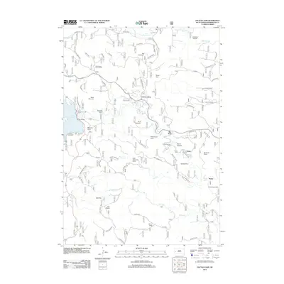
2012 Map of Pactola Dam
USGS Topo · Published 2012About this map
Pactola Reservoir and the Pactola Dam dominate the western portion of this Pennington County landscape, where the waters of Rapid Creek are impounded within steep canyons. The map illustrates a mountain community characterized by dispersed settlements like Johnson Siding and Hisega, connected by winding roads such as Pioneer Avenue and the Big Bend route.
Find a feature on this map
83 named features on this map. Tap any name to fly to it.
Don’t see what you’re looking for? This feature index may not catch every label — zoom into the map to look around manually.
Map Details
Editions of this 2012 Pactola Dam Map
This is the sole edition of this map. No revisions or reprints were ever made.
Other maps of this area

1893 · Rapid
USGS Topo · 1:125,000

1894 · Deadwood
USGS Topo · 1:125,000

1894 · Hermosa
USGS Topo · 1:125,000

1896 · Harney Peak
USGS Topo · 1:125,000

1898 · Rapid
USGS Topo · 1:125,000

1901 · Hermosa
USGS Topo · 1:125,000

1901 · Harney Peak
USGS Topo · 1:125,000

1901 · Deadwood
USGS Topo · 1:125,000

1903 · Rapid
USGS Topo · 1:125,000

1916 · Deadwood
USGS Topo · 1:125,000