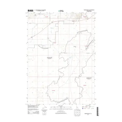
2013 Map of Paddelford Flat
USGS Topo · Published 2013About this map
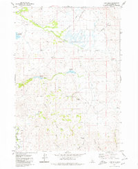
Craters of the Moon National Preserve dominates this section of the Idaho landscape, showcasing the volcanic geology that defines the region. The map reveals the intricate water management and ranching history of Blaine County through the High Line Canal and the Huff Creek Corral settlement area. The terrain transitions from the deep depressions of Mints Canyon and Long Canyon in the north to the open expanse of Paddelford Flat. Water sources in this arid environment are critical points of interest, including the isolated Paddelford Flat Lake, Huff Lake, and Wheatly Pond. Transportation across the lava fields and flats is facilitated by a network of rural routes such as Laidlaw Park Rd and Fish Creek Reservoir Rd, which link the various drainages and seasonal water bodies like Fish Cr and Huff Cr.
Find a feature on this map
21 named features on this map. Tap any name to fly to it.
Don’t see what you’re looking for? This feature index may not catch every label — zoom into the map to look around manually.
Map Details
Editions of this 2013 Paddelford Flat Map
This is the sole edition of this map. No revisions or reprints were ever made.
Other maps of this area

1955 · Idaho Falls
USGS Topo · 1:250,000

1958 · Idaho Falls
USGS Topo · 1:250,000

1972 · Little Park
USGS Topo · 1:24,000

1972 · Laidlaw Butte
USGS Topo · 1:24,000

1972 · Blizzard Mtn South
USGS Topo · 1:24,000

1978 · Craters Of The Moon
USGS Topo · 1:100,000
1979 · Paddelford Flat
USGS Topo · 1:24,000
1979 · Pagari Well
USGS Topo · 1:24,000
1979 · Wagon Butte
USGS Topo · 1:24,000
1979 · Lake Hills
USGS Topo · 1:24,000