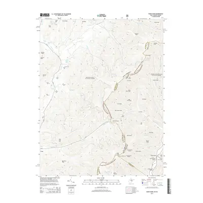
2014 Map of Paddy Knob
USGS Topo · Published 2014About this map
Paddy Knob stands as a prominent landmark along the high ridges of the Allegheny Mountains, marking the intersection where the Monongahela National Forest and George Washington National Forest meet. This survey captures a landscape defined by sharp elevation changes and deep valleys such as Bear Hollow and Kent Simmons Hollow. The terrain is characterized by a network of drainage systems including Knapp Cr and Galford Run, which carve through ridges like Chestnut Ridge and Mad Sheep Ridge. For genealogists and local historians, the map is particularly useful for its documentation of family-named burial sites scattered through the uplands, including Dilly Cem, Shinaberry Cem, and the Bussard Cem. The small settlement of Frost provides a point of reference along WV-92, while the Paddy Knob Lookout Tower indicates a history of fire surveillance in these heavily timbered highlands.
Find a feature on this map
69 named features on this map. Tap any name to fly to it.
Don’t see what you’re looking for? This feature index may not catch every label — zoom into the map to look around manually.
Map Details
Editions of this 2014 Paddy Knob Map
This is the sole edition of this map. No revisions or reprints were ever made.
Other maps of this area

1901 · Monterey
USGS Topo · 1:125,000

1922 · Cass
USGS Topo · 1:48,000

1923 · Warm Springs
USGS Topo · 1:48,000

1924 · Cass
USGS Topo · 1:62,500

1926 · Warm Springs
USGS Topo · 1:62,500

1941 · Monterey
USGS Topo · 1:62,500

1944 · Monterey
USGS Topo · 1:62,500

1946 · Warm Springs
USGS Topo · 1:62,500

1946 · Williamsville
USGS Topo · 1:62,500

1949 · Charlottesville
USGS Topo · 1:250,000