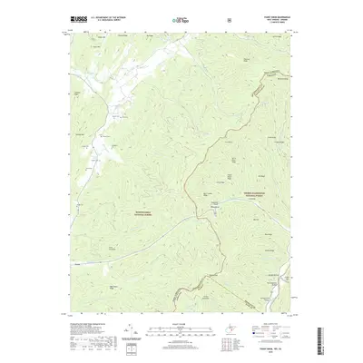
2019 Map of Paddy Knob
USGS Topo · Published 2019About this map
Paddy Knob stands at the intersection of the Virginia and West Virginia border, anchoring a high-elevation landscape divided between the Monongahela National Forest and George Washington National Forest. The map documents a rugged interior where family history is etched into the terrain through numerous small burial grounds, including Buzzard Cem, Dilley Cem, and Shinaberry Cem. These sites, often situated near springs like Chocklett Spring or along the gaps of Charley Ridge, suggest a history of isolated mountain homesteads long since incorporated into federal forest lands.
Find a feature on this map
64 named features on this map. Tap any name to fly to it.
Don’t see what you’re looking for? This feature index may not catch every label — zoom into the map to look around manually.
Map Details
Editions of this 2019 Paddy Knob Map
This is the sole edition of this map. No revisions or reprints were ever made.
Other maps of this area

1901 · Monterey
USGS Topo · 1:125,000

1922 · Cass
USGS Topo · 1:48,000

1923 · Warm Springs
USGS Topo · 1:48,000

1924 · Cass
USGS Topo · 1:62,500

1926 · Warm Springs
USGS Topo · 1:62,500

1941 · Monterey
USGS Topo · 1:62,500

1944 · Monterey
USGS Topo · 1:62,500

1946 · Warm Springs
USGS Topo · 1:62,500

1946 · Williamsville
USGS Topo · 1:62,500

1949 · Charlottesville
USGS Topo · 1:250,000